The secret of the devastating 2011 tsunami smoldered beneath the seafloor. Matt Davenport drills into the science. Illustrated by Rachel Morris and Thao Do.
Emily Brodsky knew something was wrong before she answered her phone. Sitting in her kitchen in early May 2012, Brodsky, a geophysicist at UC Santa Cruz, stared at the number on her caller ID. The Japanese country code could only mean trouble.
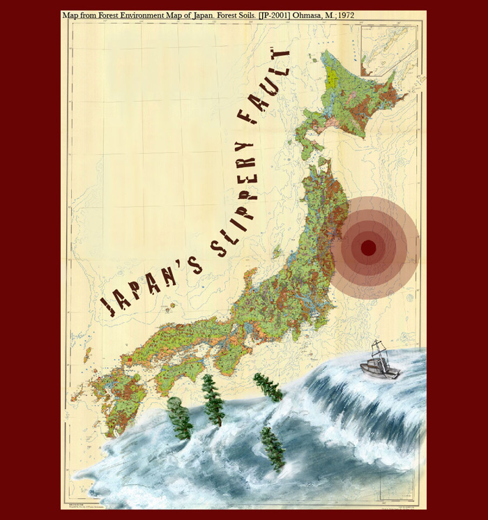
Fourteen months earlier, a magnitude 9.0 earthquake sent the ocean spilling over Japan’s eastern shores. Water rushed inland for miles, reaching depths of up to 133 feet before receding. The tsunami scoured the coast, leaving hundreds of billions of dollars of destruction and a leaking nuclear power plant in its wake. Nearly 20,000 people died.
Before then, few geologists believed the Tohoku-Oki fault could release such a ferocious earthquake. But in six minutes, the quake cast decades of seismological dogma into doubt. The clues to how it did so lay within the astonishing power of the earthquake itself.
Violent temblors create heat as the planet’s rocks shatter and scrape against one another. In 2008, Brodsky and other leading geoscientists devised a plan to drill into the fault of the next big earthquake, see what it was made of, and take its temperature while it was still warm. This might explain how the quake happened—and whether other faults posed similar threats.
On May 6, 2012, an international team of researchers were putting this plan to the test for the first time. They floated above the Tohoku fault in the only scientific drilling vessel up to the task. But four miles of ocean covered the fault, and researchers had never drilled so deep at sea. Now, Brodsky’s caller was telling her it might stay that way.
The longest deep-sea drill in science had seized up. A fleeting chance to understand giant offshore earthquakes was dissipating under the waves.
The really big one
Brodsky has studied faults around the world—from China to Italy to California—for nearly two decades. Yet modern plate tectonics has existed for only about twice that time. There are still major gaps in our understanding of earthquakes. We do, however, know how they start.
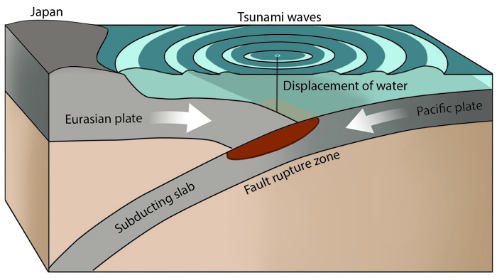
Giant masses of crust grind against each other where tectonic plates meet. About 120 miles east of Japan, the plate supporting the Pacific Ocean is slowly skidding under an Asian continental plate. This strains the rigid crust, and force builds up at crustal cracks called faults. As if the moving plates were cranking a colossal jack-in-the-box, the tension eventually becomes too great and pop goes the fault. The crust lurches, sending the earth into seismic fits.
What we don’t know so well is how earthquakes stop—or why some don’t.
Rocks on either side of the fault scrape against each other, creating friction that slows and eventually stops the slippage. This friction also sparks heat, just as it does when we rub our hands together. Friction plays a pivotal role in how far—and how violently—the two sides of a fault slip, but scientists can’t suss out the specifics from the scribbles of seismometers.
If scientists measured the heat a quake churned out, however, they could determine how hard friction worked to stop the sliding earth. To do this, they would have to stick a thermometer inside the fault of a fresh earthquake—preferably a huge one with plenty of heat. Researchers had tried before, but their results were inconclusive. The faults had cooled off before scientists probed them.
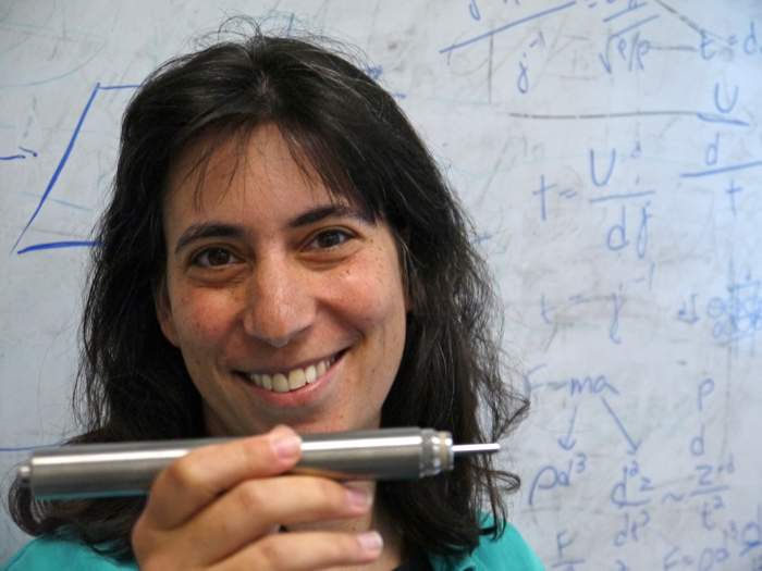
Photo: Matt Davenport
UC Santa Cruz seismologist Emily Brodsky holds a temperature gauge used to measure the fading heat from an earthquake fault after it ruptures.
Brodsky estimated scientists had two years to measure a fault’s heat after a large quake. This left little time for organizing scientists or tracking down fault-drilling equipment once a quake happened. In 2008, Brodsky helped bring scientists from ten countries together in Tokyo to plan a response beforehand. They identified the resources they would need to marshal and the faults most likely to unleash the next big quake. The researchers agreed on eleven locations worldwide, including Alaska, Turkey and New Zealand. Not one site was under the ocean.
But after the Tohoku quake on March 11, 2011, Brodsky believed scientists had to go after its fault. The international committee agreed. Nearly everyone had overlooked the threat that ravaged Japan. If they wanted to avert similar catastrophes, “It was really quite clear what the right thing to do was,” she says. Brodsky became a leader in putting the plan into action, but she and her colleagues would need an assist getting to the undersea fault.
The earthquake’s hypocenter—the point within the crust where it began—was about 20 miles below sea level, nearly three times deeper than the deepest ocean trench. Even so, the quake’s energy shot to the seafloor, which sprang up almost 20 feet and catapulted an incredible mass of water toward Japan. Any large earthquake that ruptures at a similar depth undersea will likely trigger a tsunami. But the Tohoku event did something unexpected and deadly.
Friction usually halts a fault’s slipping motion before it reaches the surface. While the sides of a fault skid into new positions around the hypocenter, the seafloor tends to end where it was before the quake. If the seafloor does move, it’s a fraction of the lurch near the hypocenter—or so said conventional seismological wisdom.
Illustration: Rachel Morris
But during the Tohoku quake, the seafloor moved up to twice as much as the earth at the hypocenter. The quake shoved the seafloor 150 feet east, the largest surface slip ever recorded. This bolstered the tsunami and made the earthquake a mystery.
To solve this mystery, the Japan Agency for Marine-Earth Science and Technology, or JAMSTEC, volunteered its massive drilling ship, the Chikyu. Scientists usually had to wait a decade to book the Chikyu. But after the disaster, JAMSTEC carved out two months in 2012 for the ship and its drill—which could reach depths of six miles—to examine the fault.
Lows on the high seas
On April 1, 2012, UCSC geologist Patrick Fulton watched Mt. Fuji slowly disappear as he and about 30 other scientists sailed out of Shimizu port aboard the Chikyu. His duty was stringing together 55 titanium-encased temperature sensors that would slip inside a 2,700-foot-long, 4.5-inch-wide steel tube. Engineers would then lower the tube into a half-mile puncture wound in the Tohoku fault. There it would rest for nine months: an underwater observatory recording the earth’s temperature, once every 10 seconds. The team would then drill a second hole nearby to carve out cylindrical chunks of the fault, like a deep-sea apple corer.
That’s how they planned it, anyway.
After the ship's two-day journey from port, a near-cyclone raged at the drill site. Winds screamed at nearly 70 miles per hour. There would be no stepping outside, let alone drilling. Though taller than a 30-story building, the Chikyu shuddered and yawed with every 40-foot wave. Scientists passed the time in their bunks, the mess hall or the laboratory deck—all stacked in the same slender compartment.
“Even though [the ship is] two football fields long, we end up living in this eight-story apartment complex,” Fulton says. “You get stuck working within 30 feet of everything.”
This animation displays Japan's gigantic Chikyu research vessel and its drilling rig. Click on "Dimensions" for a series of size comparisons; use the "Next" button to navigate, and click on images as instructed. Click on "Tohoku Expedition Slideshow" for a set of onboard photos. Photo credits: JAMSTEC/IODP, Patrick Fulton, Virginia Toy
Illustration: Thao P. Do
Days after the storm passed, 10-foot swells persisted—large enough to snap a drill hanging beneath the ship. Fulton waited and practiced stringing his sensors together, hoping he’d get the chance to deploy them. When the sea did settle, technicians assembled four miles of drill pipe, one 30-foot segment at a time. Nearly three weeks into the cruise, the crew finally started burrowing into the seafloor.
On April 25, drillers bored the deepest hole ever made at sea for research, but they didn’t trust it was firm enough to hold the observatory. As they began preparing a new hole, a link in the four-mile-long drill malfunctioned, severing their control over it. The drill bit had chewed over 300 feet into the crust, but it would go no deeper.
Back in her kitchen in Santa Cruz, Brodsky was learning this in a phone call. The Chikyu crew would need to pull up the drill one pipe segment at a time and rebuild it with new parts. There wouldn’t be enough time to install an observatory and to pull cores from the fault in a separate hole. Brodsky and the expedition leaders discussed which goal to abandon.
“We have all these geologists on board and they have nothing to analyze,” Fulton says. “We made the decision that we were going to give up on the observatory and we were just going to core.” In other words: there would be no temperature measurements.
“I went to bed depressed,” Brodsky recalls.
Fishing for faults
Three days later, drillers began lifting cores to the surface around the clock. Scientists were alternating 12-hour shifts to keep up.
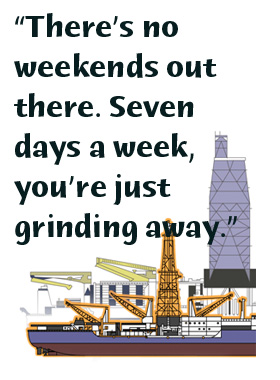
“There’s no weekends out there. Seven days a week, you’re just grinding away,” says UCSC geologist Casey Moore, a veteran of more than a dozen ocean drilling expeditions. “Everything came down to the last couple weeks.”
The researchers needed something that showed how the Tohoku quake had ruptured. About a half-mile into the seafloor, they found it: a three-foot-thick clay slab with the telltale markings of earthquakes. “There’s some pictures of people just beaming over this one-meter interval of really sheared-up stuff,” Moore says.
Podcast produced by Matt Davenport. Click on arrow to play.
Unlike rock, this clay was weak and squishy. Scores of earthquakes over the millennia had left scars in the clay: thousands of striations showing where the slippery material had sheared and shredded.
Drillers continued pulling up cores. When they hit solid rock again, they knew they passed through the clay into the other side of the fault. Only 15 clay-filled feet separated the two solid slabs of earth. Oceanic and continental crust sandwiched this thin layer of clay. Researchers needed friction measurements to prove their hunch, but they suspected it had lubricated the earthquake. If so, those 15 feet had devastated a nation.
Warm wishes, granted
While researchers analyzed core samples, JAMSTEC leaders decided to take one more run at installing the temperature gauges. This was their only chance to measure the fault’s friction and fully explain what happened in March 2011. “[JAMSTEC] sent the ship back out for another three weeks and said try again, which has never happened before. Ever,” Brodsky says.
Before the second cruise, the Chikyu sailed to a dry dock for repairs. The tsunami had maimed one of its six thrusters, each the size of a studio apartment, which had to fire in perfect coordination to keep the ship steady while the crew worked. On July 5, the Chikyu returned to the drill site. Fulton returned to the ship on a helicopter and prepared to install the observatory.
Compared to the first trip, everything went smoothly. The crew drilled a hole and sent a TV camera to the seafloor. They would need to see what they were doing to guide their temperature gauges into a narrow hole at the bottom of the ocean. Fulton and technicians tied the sensors together and slid them into a steel tube. Engineers attached the tube to a pipe segment and lowered it into the ocean, stopping just above the borehole. They had one chance to drop it inside. Brodsky had flown in from California to watch this moment.
“It was like threading a needle from miles away,” Fulton says. Working with the drilling superintendent, Fulton watched the underwater camera footage to align the tube with the hole. They asked the captain to scoot the ship a few feet to the right. Thrusters whirred as they nudged the ship. Moments later, the pipe swayed into view like a limp spaghetti noodle. When it settled above the hole, Fulton yelled, “Now now now!”
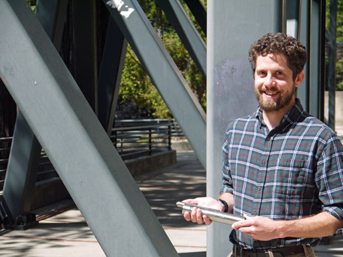
Photo: Matt Davenport
Geologist Patrick Fulton of UCSC joined scientists aboard the Japanese research vessel Chikyu to probe what caused the offshore fault to lurch so dramatically.
Engineers dropped the 2,700-foot-long thermometer into a hole about the size of a soccer ball. Brodsky didn’t believe they had really done it until she watched the replay from the underwater TV camera.
This observatory recorded the fault’s temperatures every 10 seconds for nine months. Back on land, geologist Kohtaro Ujiie tested core samples in his lab at the University of Tsukuba—the same place he was when the earthquake struck. By smooshing the ends of two cores together and spinning them, he could simulate an earthquake and measure the heat it generated. When Ujiie examined the Tohoku clays, he found they were twice as slippery as any fault material he had measured before. The clay had likely greased the quake, but Fulton’s data would complete the picture.
In April 2013, Fulton returned to Japan to watch a remotely controlled submarine retrieve his sensitive gauges from the bottom of the ocean. A pilot maneuvered the sub to the observatory and, using a robotic claw, latched onto the thermometer column. The sub unsheathed the sensors from the crust and ascended to the surface, clutching the first temperature measurements from an undersea fault.
Once the sensors came aboard, Fulton found an anomaly in the readings. The sensors nearest the fault recorded temperatures about one degree Fahrenheit warmer than the others. Each gauge acted like a camera, snapping more than 2 million photos of the excess heat as it dissipated through the surrounding rock over nine months. Flipping through the pictures, Fulton became the first person to watch the vestiges of an earthquake’s friction meander through the planet.
Knowing how the heat behaved, Fulton could create the fault’s thermal images from times before his sensors started recording. Fulton saw how much heat was generated by the fault’s friction during the earthquake. He then calculated the clay’s coefficient of friction, a number that would tell how hard the fault’s friction worked to stop the earthquake. It was extremely low—0.08—but it agreed with Ujiie’s laboratory measurements. With a coefficient of friction so close to zero, the clay had all but cut the brakes on the Tohoku quake.
This confirmed the team’s hypothesis: a thin patch of clay let the fault skate across itself effortlessly, shaking the crust all the way to the seafloor. The researchers published their findings in a series of three papers in the Dec. 6, 2013 issue of Science—a series that Brodsky now calls “The Trilogy”—and garnered international press coverage.
Danger zones
While some scientists had theorized low-friction quakes were possible, few had believed it. Nobody had measured one before. “The large slip at a shallow depth along the trench was unexpected for most seismologists and government officials,” says geophysicist Hiroo Kanamori of the California Institute of Technology. Kanamori, Brodsky’s former mentor, is the Japanese scientist who helped define the earthquake magnitude system that replaced the Richter scale. We now must take the threat of these quakes seriously, he says. “The result is significant because it provides hard evidence that low-friction fault motion could happen.”
Faults around the globe may harbor similar clay layers, hiding hazards that can unleash catastrophic tsunamis. Places like Barbados, New Zealand, and South Africa could be at risk. The Cascadia fault, similar in many ways to Tohoku, rests undersea, not far from Portland, Seattle and Vancouver.
Geophysicist Kelin Wang of the Geological Survey of Canada in Sidney, British Columbia believes a deep-sea drilling expedition could help quantify the threat of the Cascadia fault. Such an undertaking would better prepare the Pacific Northwest for when the fault unlooses a magnitude 9 earthquake—and a tsunami.
The next logical step is to ferret out clay-filled faults around the planet and assess their tsunami potential, Moore says. His hands are folded above an open book with a crosshatched map of the world showing where clays accumulate. They’re sitting on the bottom of every ocean. The question is, which plates feed the slippery material into faults?
Looking at the map, it’s hard not to see the planet as a gigantic ancient burial ground. Tsunami hazards aren’t coming; they’re here. But from the embers of the Tohoku tragedy, humanity may have exhumed knowledge to protect itself.
Matt Davenport B.S. (physics) Michigan Technological University Ph.D. (physics) University of California, Irvine Internship: Chemical & Engineering News
In kindergarten, my career paths were scientist or superhero. Both sounded cool, and I dug the outfits. My bodacious science teachers showed me that one of these ambitions was not science fiction. Stories about cantankerous, irreverent astronomers and a bongo-playing, Nobel-prize-winning playboy convinced me that physics was equal parts math and moxie. I fell hard.
Courting my doctorate, I cultivated forests of carbon nanotubes to sniff out gas molecules, installed nanoscopic water slides to corral flowing ions, and drilled super teensy holes to interrogate viruses. I loved building eyepieces onto an invisible world, but I learned I’m not the type of guy who can settle down with one project. Turning my lens on science itself, I can keep things fresh while igniting new romances with nature, just as my teachers did for me.
Rachel Morris B.S. (geology) University of California, Davis Internships: Monterey Bay Aquarium, Monterey Bay National Marine Sanctuary
Although I would never have called myself an artist, I grew up with a natural love of drawing. I did not, however, think of it as a future career. To me, being able to call yourself an artist was like comparing yourself to Picasso, Van Gogh, or Monet. So instead, I fought for a career in medicine, then geology, and most recently paleontology. It was not until last year, while doing a master's program in paleontology at Florida State University, that I realized being a scientist would never make me happy. It was too stiff and too stressful. Luckily, I found the scientific illustration program at CSU Monterey Bay. Being a part of this program has re-ignited my interest in science and has allowed me to see it from a brand-new, wonderful perspective. My hope is that my illustrations will encourage others to look at science in the same invigorating way that I do.
Thao Do B.S. (biology) University of Southern Indiana Internship: Mesoscope Project, University of California, San Francisco
Art has been my life-long passion, while science forms a backbone of my knowledge and motivation. I am going to continue training in various media and using different approaches to broaden my horizon. I am prepared to help bring science closer to general audiences through interesting and comprehensible visual presentations. Science illustration is not very well known by people outside of the field, let alone the people back in my home country, Vietnam. Eventually, I look forward to illustrating flora and fauna in Vietnam and Southeast Asia.

 Once the sensors came aboard, Fulton found an anomaly in the readings. The sensors nearest the fault recorded temperatures about one degree Fahrenheit warmer than the others. Each gauge acted like a camera, snapping more than 2 million photos of the excess heat as it dissipated through the surrounding rock over nine months. Flipping through the pictures, Fulton became the first person to watch the vestiges of an earthquake’s friction meander through the planet.